

|
|
1/2
|

|
|
2/2
|
Designers: Joël Meijer de Casseres
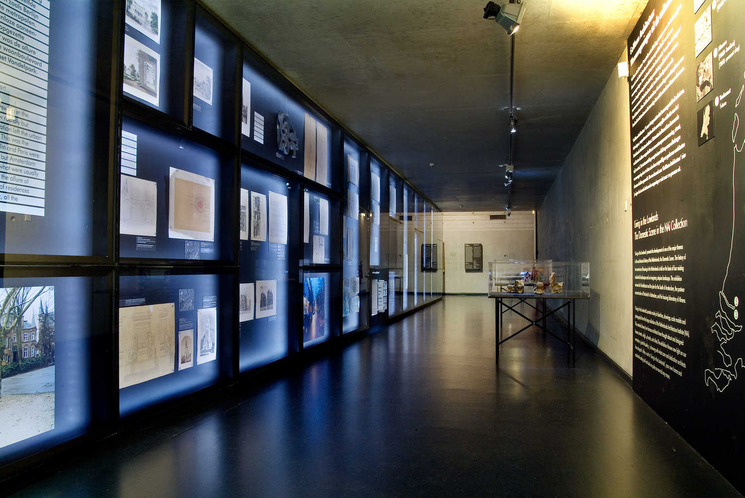
The term ‘planology’ – the science of planning – was introduced by De Casseres. This schematic representation of Eindhoven and the surrounding villages shows what he meant by this. The ‘mother city’ of Eindhoven expands within orbital roads around the city. Green parks penetrate from the outside, extending until close by the centre. A web of roads – the red lines – connects Eindhoven with the surrounding villages. These satellites would also expand due to population growth. The map by De Casseres is symbolic of the new planological thinking, by which urban expansion is designed in relation to the region.


No comments on this project yet.